Newsroom - Page 5
Search filters
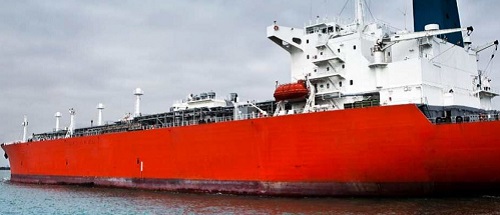
Merger of Woods Hole Group, CLS America and Horizon Marine
We are proud to announce the merger of WOODS HOLE GROUP, CLS AMERICA and HORIZON MARINE. On January 1, 2018, CLS officially merged its US-based entities: CLS America, Horizon Marine and Woods Hole...
CLS, signatory to the United Nations Global Compact
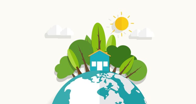
CLS was founded in 1986 and its mission ever since has been to protect people and the planet. CLS strives each day to move forward and innovate for the benefit of humanity and our environment. The...
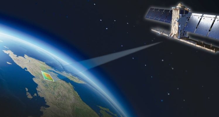
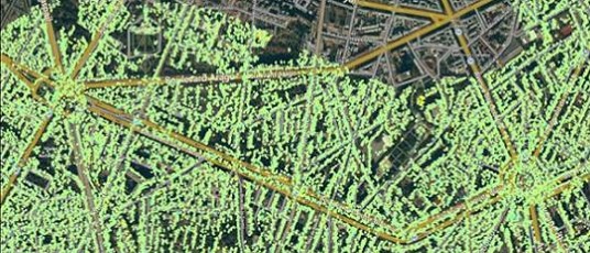
FRANCE, TERRITORIA 2017 Gold Award for the City of Dax in the use of space applications with the collaboration of TRE Altamira
Gold Award for the City of Dax in the use of space applications. CLS, a subsidiary of the French space agency CNES, is therefore very proud of this distinction ! The city of Dax had a collaboration...
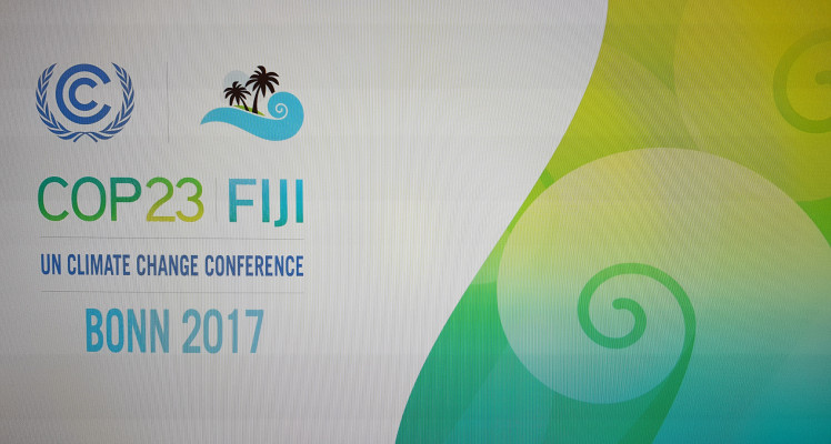
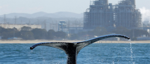
COP 23, the importance of space applications to assess global warming
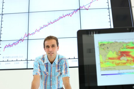
COP23 helps to make progress on instruments for implementing decisions of the Paris Agreement, ratified 2 years ago by 169 countries. Recent climate events demonstrate the urgency of taking action....
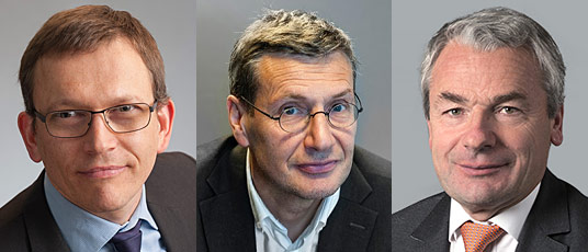
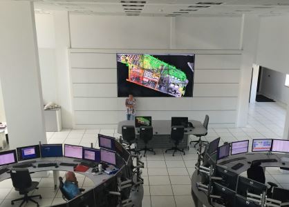
New Supervisory Board for CLS
On Wednesday, August 9, the French Ministry of Armed Forces announced that President Emmanuel Macron appointed Joël Barre as General Delegate for Armament. Following this, Antoine Seillan, CNES’s...

CLS acquires SIRS and stakes out a position in the field of satellite observation and monitoring of continental land masses
CLS, the French satellite services provider, has announced the acquisition of SIRS (Systèmes d'Information à Référence Spatiale [Information systems for space-related purposes]), a French company...
CLS acquires SIRS and stakes out a position in the field of satellite observation and monitoring of continental land masses
Download the PDF
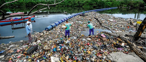
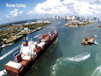
Space applications for the happiness of millions of annual holidaymakers
For the pleasure of the holidaymakers, CLS contributes during this summer to the great cleaning of the beaches. Space applications will allow during this summer to clean beaches and also to report...
CLS View
Download the PDF
LAUNCH OF ARGOS for NEXT Generations
Download the PDF The satellite-based Internet of things (IoT) will be accessible everywhere, for a sustainable planet.
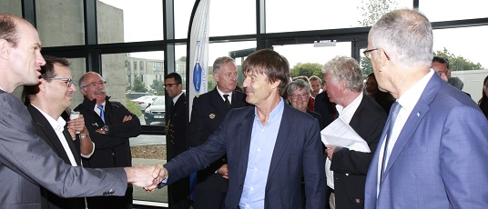
CLS, ready to take the challenge of Blue Growth
In a meeting organized with representatives of the Pôle Mer Bretagne Atlantique, Nicolas Hulot, French Minister of Ecology, set blue economy targets in a key phrase: “We must accelerate” This event...
The RATP renews its confidence in TRE ALTAMIRA
TRE ALTAMIRA, the CLS Group subsidiary, continue to apply our expertise to support the RATP (the public operator for the transport of Paris) in their efforts to ensure greater safety and security...
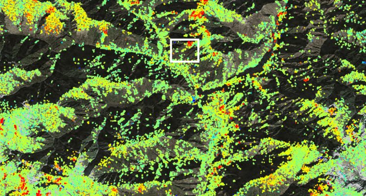
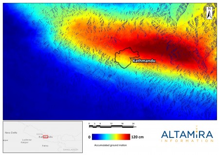
Precursor of Maoxian Landslide Measured from Space
On 24 June 2017, a massive landslide hit a village in Maoxian county in Sichuan province, south-western China, destroying 40 homes and killing dozens of people (BBC news here). Authorities suggest...
SALON DU BOURGET 2017: CLS develops and promotes space applications
The Paris Air Show 2017 "Salon du Bourget" is a privileged moment to describe the new activities and the potential offered by space solutions. In the current context of digital transition, space...
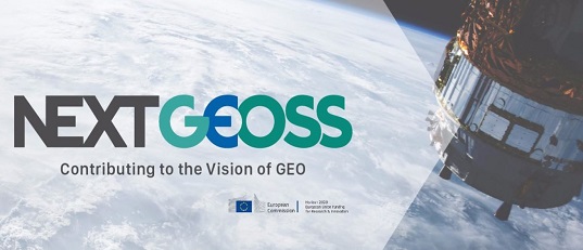
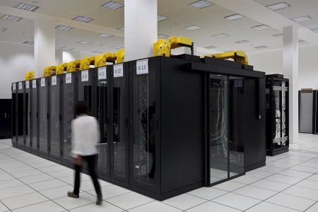
NEXTGEOSS, a European data hub for the future GEOSS
The H2020 NextGEOSS project, a European contribution to GEOSS, will develop the next generation of European Earth Observation data broker where users can access data and deploy applications close to...
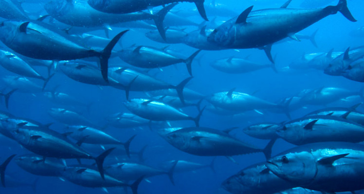
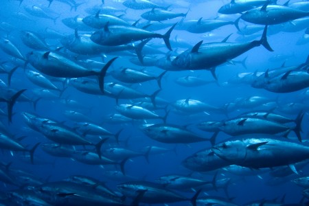
World Tuna Day – what can we do for tuna from space?
A world tuna day? Why ? The United Nations General Assembly, by consecrating 2 May "International Tuna Day", invites all Member States, United Nations agencies, other international and regional...
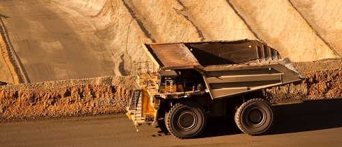
CLS and IDS join forces to enhance mines security
There are innumerable gold, tin, copper or manganese mines. The biggest open-pit mine in the world, in Australia, has a 13,000-strong workforce, covers an area of 12 square kilometers and is one...
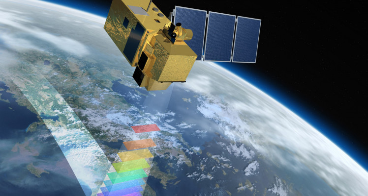
Sentinel 2, a valuable tool in environmental studies
The implementation of optical images with other satellite data makes it possible to implement large-scale strategic plans Inland water observation Merged with the altimetry data, the Sentinel-2...
CLS keep an eye on the oceans
With nearly 20 years of expertise, CLS uses data from several satellites including sentinels to develop new solutions to protect the planet, its environment, its biodiversity and its inhabitants....
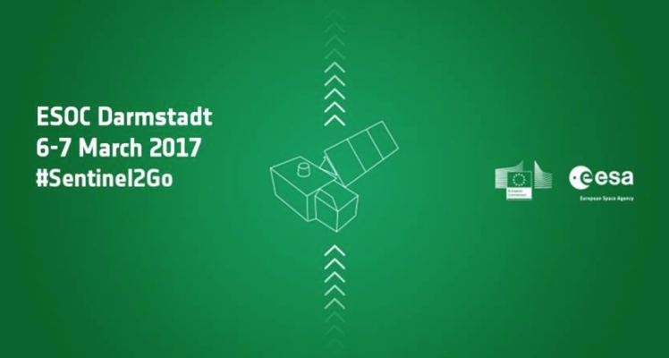
Sentinel 2-B, soon !
Sentinel-2A will be joined by its twin, the Sentinel-2B satellite on the night of March 6-7. These two satellites of optical imagers will ensure a revisit of the same site every 5 days. The Sentinel...
CLS acquires Woods Hole Group
CLS, the French satellite services provider, has announced the acquisition of the Woods Hole Group, an American company specialising in environmental, scientific, and engineering consulting. CLS is...
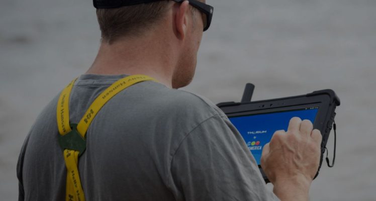
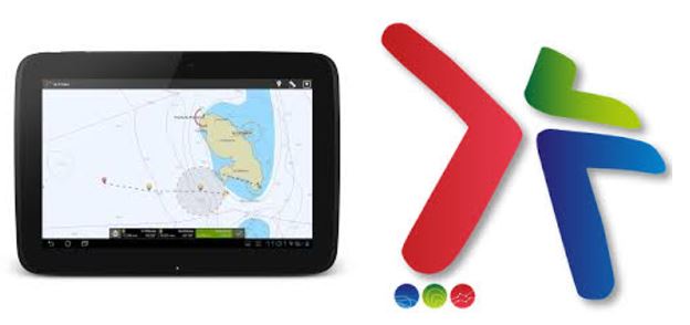
CLS America and Xplore Partner to Launch the Thorium X, The First Satellite Communications Rugged Tablet for Global Industries
The Intel®-powered Thorium X features an integrated Iridium Short Burst Data (SBD) modem and flexible satellite antenna that significantly expands the reliability, speed, and cost-effectiveness of...
Fulcrum Maritime Systems joins CLS Group
CLS Group and Fulcrum Maritime Systems (FMS) joined forces at the end of 2016 to become a world-leading maritime surveillance service provider. CLS Group infrastructure and worldwide network, as...
CLS Mag “CELEBRATING 30 YEARS”
Download the PDF ANNIVERSARY
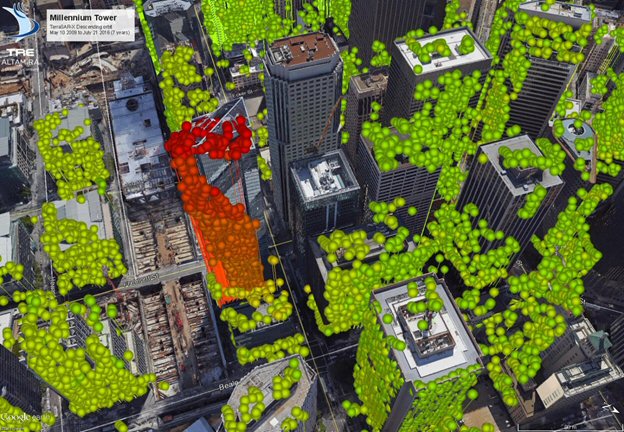
San Francisco Millenium Tower: InSAR results by TRE ALTAMIRA
TRE ALTAMIRA, a CLS group company has processed 7 years of TerraSAR-X data to measure movement on and around the Millennium Tower. The 179 scenes of TerraSAR-X provided a highly precise historical...
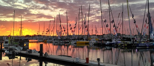
The Vendée Globe a race under high satellite surveillance.
The Vendée Globe is the only solo, non-stop, without assistance sailboat race around the world. Nicknamed “Everest of seas”, only 71 sailors under 138 managed to reach the fish line since its...
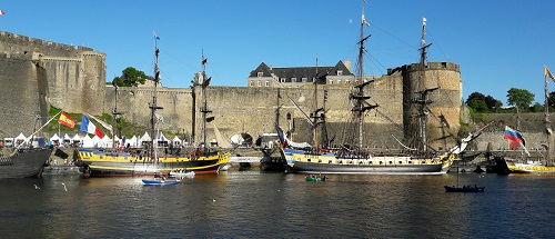
CLS at the Sea tech Week
From 10 to 14 October 2016, 10th edition of Sea Tech Week Sea Tech Week, international marine science and technology week, brings to the city of Brest (France) every two years leading international...
Brest 2016: “Oceans and climate”
Several actors of Quai des Sciences in Brest (france), including CLS, have been decided this year to promote the role of the ocean on climate. Climate issues are opening broad scientific and...
JO 2016 : CLS provides satellite data to help clean the Bay of Rio de Janeiro
For over a year, CLS has provided satellite data to help clean the bay of Rio de Janeiro in the run-up of the 2016 Olympics. A major task was given by the Brazilian government to CLS and its...
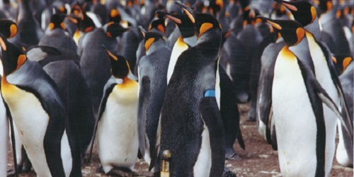
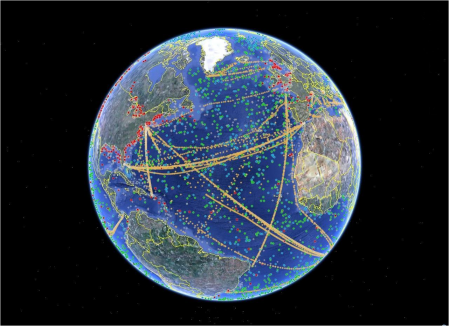
100, 000 animals tracked for 30 years by satellite
Image © C. Bost CEBC-CNRS Global warming in the Arctic means that ice fields are forming later and later in the year. Polar bears linger for longer on the coastlines. Their hunger pushes them to...
CLS at Toulouse Space Show
From 28 to 30 June 2016, the sixth edition of the Toulouse Space Show is one of the must-attend event concerning space applications. CNES, ESA, industry and researchers are working on satellite...
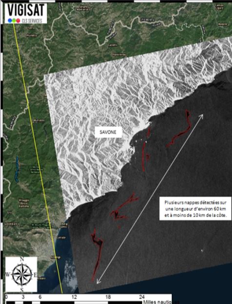
CLS & Sentinel 1 : Mediterranean pollution
CLS detects oil spills by using satellite radar images, determines the drift trajectories of oil slicks to identify polluters and the possible source of the pollution and finally, supplies the...
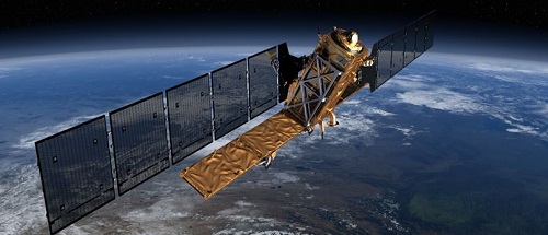
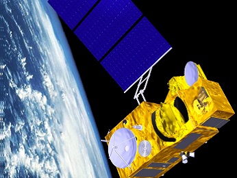
With the successful launch of Sentinel-1B, on the evening of 25 April, CLS is continuing to watch over our planet
Download the PDF On Monday 25 April, at 23h02 (UTC), the European Sentinel 1-B satellite was placed in orbit by a Soyuz launcher from the European space port at Kourou in French Guiana. CLS, a...
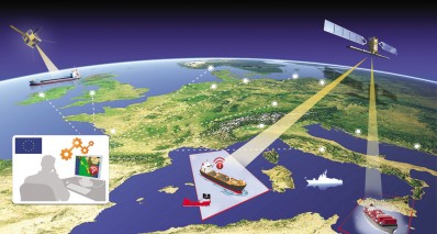
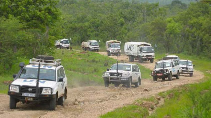
Maritime piracy : a collaborative approach
Collation and dissemination of information regarding maritime piracy and armed robbery at sea
CNES fetes 30th anniversary of its subsidiary CLS in Toulouse
Download the PDF
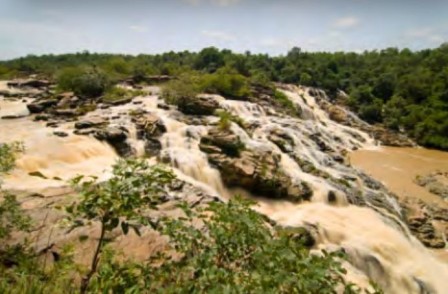
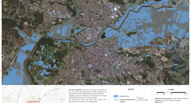
Hydrology : monitoring floodwaters
The two major challenges covering all of these themes are the preservation of environmental resources and ecosystems, and universal access to water (mainly for drinking) and sanitation. In this context, CNES has been commissioned to support the development of satellite applications and services in the field of water, in particular.
SENTINEL-3, A world of applications
Download the PDF climate, water resources, marine resources, biodiversity, melting ice, detection of icebergs
SENTINEL-3, higher resolution, more detailed data
How can we monitor the effects of global warming, optimize management of our freshwater resources, help traditional local fishermen exploit marine resources in a sustainable way, and ensure a safe route for skippers in solo round-the-world races?
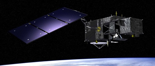
With Sentinel-3, CLS plays the guardian of the water
With Sentinel-3, CLS plays the guardian of the water
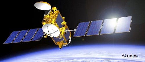
JASON-3 successfully launched : sunday 17 january
Jason-3 will ensure supporting operational oceanography and monitoring of the sea-level trend, a key indicator of climate change.

COP21: An unprecedented agreement, and a continuing mission for the space sector
Space-based technologies are involved in climate monitoring
ARGO, The planetary thermometer
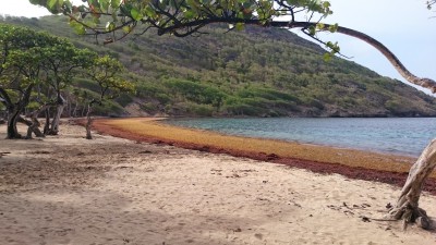
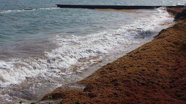
Sargassum seaweed
French West Indies beach invaded by Sargassum seaweed. CLS maps the seaweed ahead of time so it can be collected before reaching the shore.
The Fresh water Challenge
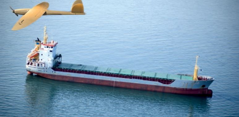
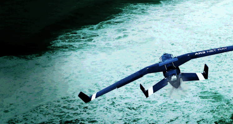
SATELLITE-LINKED DRONES ARE CLIMATE CHANGE SENTINELS
New technologies for environmental monitoring.
Extreme events managed from space : earthquakes
Extreme events managed from space : climate refugees
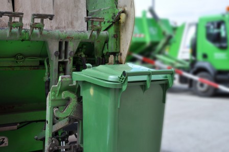
Throw away less : it’s good for your planet and good for the planet
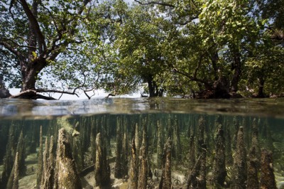
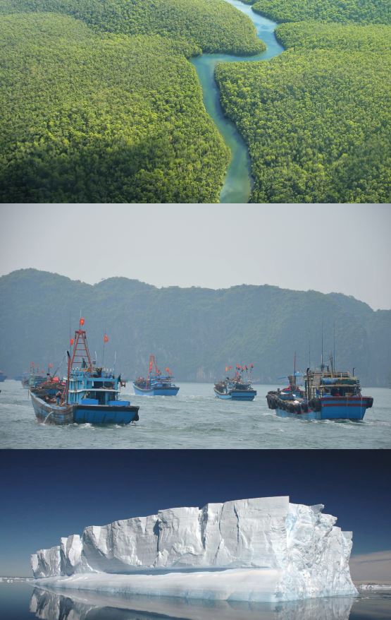
Protecting Mangrove Forests
In 2015, the COP21, also known as the Paris Climate Change Conference, will attempt to obtain a universal, legally binding agreement on the climate, after more than 20 years of negotiations at the United Nations. Its goal is to keep global warming below 2°C. International maritime traffic is responsible for 2% of the total emissions of greenhouse gases.
Limiting CO2 emissions at sea
Extreme events managed from space : MOVIMAR
Often in the news, extreme climate situations are sadly becoming more frequent. How are we to deal with violent meteorological phenomena, cataclysmic earthquakes and migration of climate refugees? By using CLS’s world-wide operational satellite solutions for early warning of hurricanes or for managing emergency aid vehicles. A closer look at these operations.
Sustainable management of marine resources and climate
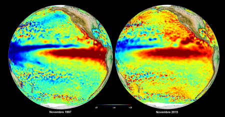
El Niño’s back
Since 1997, El Niño had not reappeared with such intensity.
Mean sea level is one of the best indicators of climate change
CLS Mag special issue on climate
Download the PDF CLS Mag special issue on climate
Acquisition of TRE (Tele-Rilevamento Europa)
CLS acquires TRE and becomes the world leader in highly accurate ground movement measurements using satellite radar images.
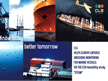
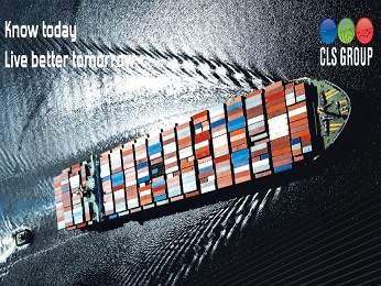
CLS helps Europe to enforce maritime emissions monitoring with the ESA Feasibility Study “STEAM”
Download the PDF CLS helps Europe to enforce maritime emissions monitoring with the ESA feasibility study "STEAM" (Ship Sulfur Trails Emissions Aerial Measurements)
CLS confirmed as Major LRIT ASP
Download the PDF Following a call for tender, CLS is pleased to announce that EMSA has renewed its trust in CLS for the provision of LRIT ASP services.
CLS is appointed as conformance testing for Singapore
Download the PDF With the recognition by Liberia LISCR and Singapore MPA, CLS is today confirmed as a major LRIT testing ASP worldwide.
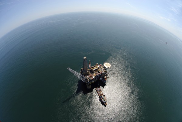
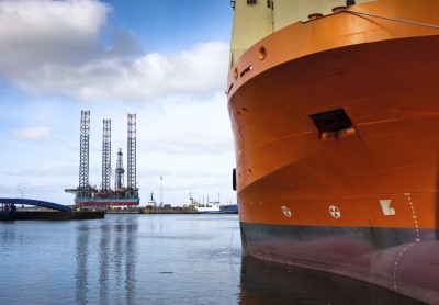
CLS will be present at Offshore Europe 2015
Offshore Europe is one of the world’s largest technical conference and exhibition for the offshore E&P industry, with over 1,500 exhibitors from over 100 countries in attendance. We’ll be there ! Visit our stand (Booth 4C100).