← Back
Precursor of Maoxian Landslide Measured from Space

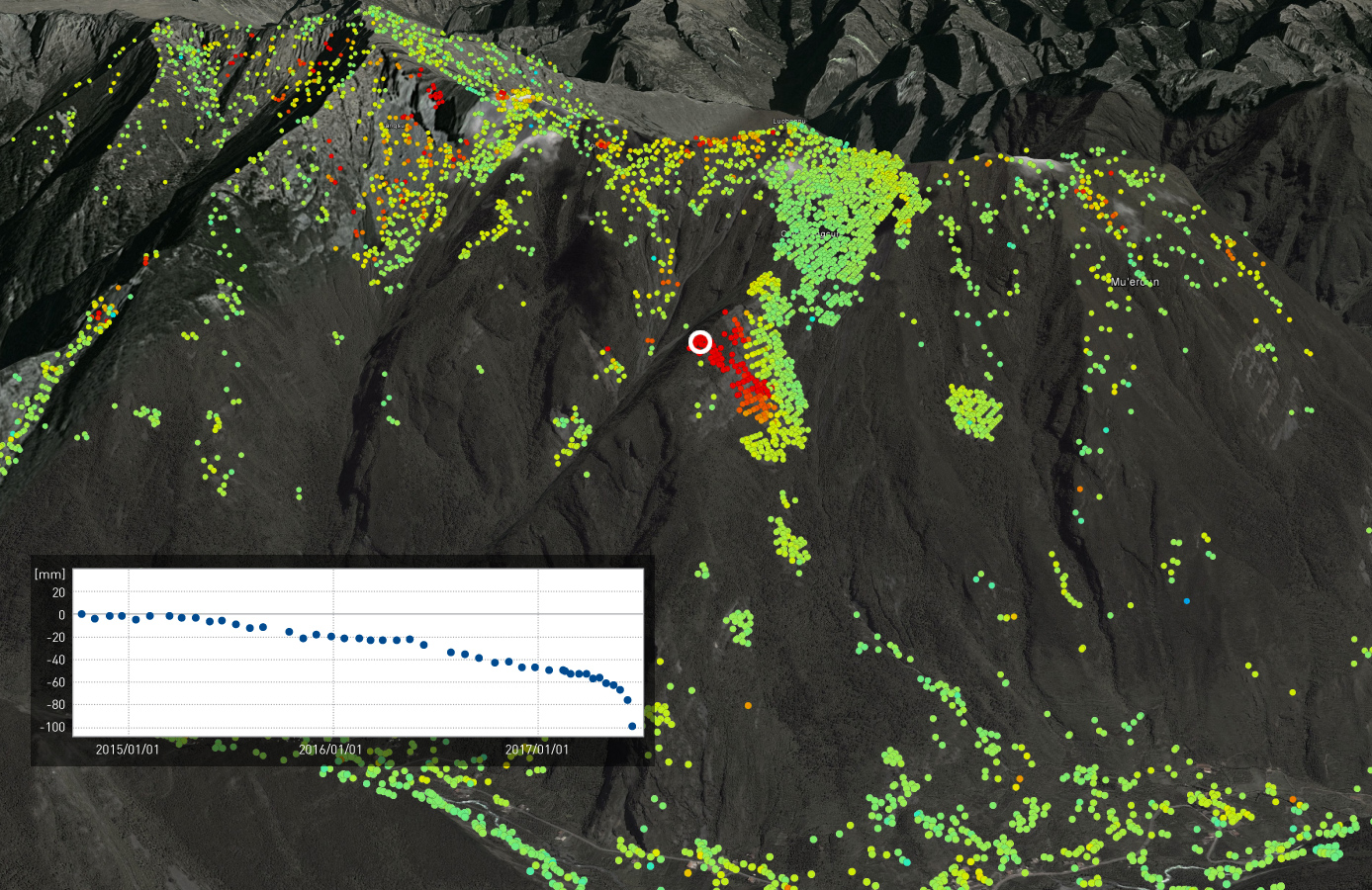
On 24 June 2017, a massive landslide hit a village in Maoxian county in Sichuan province, south-western China, destroying 40 homes and killing dozens of people (BBC news here). Authorities suggest the event was triggered by prevailing heavy rains.
TRE ALTAMIRA has processed the entire archive of 45 Sentinel-1 satellite radar scenes acquired since October 2014 over the Maoxian area in less than 3 hours since reception of the last image. This has been achieved using our SqueeSAR™ processing chain in combination with in-house big-data computing power and SAR expertise.
Read more on TRE ALTAMIRA website