← Back
Extreme events managed from space : earthquakes

Often in the news, extreme climate situations are sadly becoming more frequent. How are we to deal with violent meteorological phenomena, cataclysmic earthquakes and migration of climate refugees? By using CLS’s world-wide operational satellite solutions for early warning of hurricanes or for managing emergency aid vehicles. A closer look at these operations.
Tectonic plates are being subjected to phenomenal pressures. Earthquakes created by these shifting plates are thus occurring more frequently. Altamira information, a CLS subsidiary, offers a solution for providing terrain maps and expertise in interpreting radar satellite data for the
zones concerned.
By measuring ground movements and highlighting differences before and after events, Altamira facilitates the work of rescue teams while indicating which zones are likely to suffer aftershocks, thus providing backup for relief workers in the field during climate catastrophes.
Related Posts:
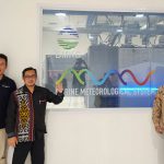 New step for the Indonesian Maritime Meteorological System (MMS1) delivered by CLS and its partners : High Performance Computing is now operational at BMKG HQ
 CLS, Data Partner for Our Planet Ocean
 CLS’ Water Platform: Digitizing Water Resilience