← Back
Sargassum seaweed

French West Indies beach invaded by Sargassum seaweed. CLS maps the seaweed ahead of time so it can be collected before reaching the shore.
Since 2011, brown Sargassum seaweed has been amassing on the Caribbean and South American shoreline. As it decomposes, it emits hydrogen sulphide gas, harmful to humans in high doses, and a foul smell similar to that of a rotten egg. To combat this problem, CNES has given CLS the task of implementing an operational satellite surveillance system. The latter is based on multi-satellite detection using radar and optical instruments, in addition to a drift model. Radar technology is a key advantage in this area because it is unaffected by cloud cover and can operate both day and night.
CLS scientists such as Romain Husson have pinpointed the signature of Sargassum seaweed in radar images. Today, CLS maps the seaweed offshore. This information is crucial for supporting collection operations and for other players affected. The phenomenon could well be related to global warming because it is likely that the rise in water temperature is one of the factors accounting for the seaweed’s proliferation.
Demo « Highlight of the Copernicus Sentinel-1A products » https://eoda.cls.fr
Sentinel-1A: ESA launches first satellite Copernicus program
CLS, The first French collaborative SENTINEL-1 receiving station
Related Posts:
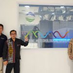 New step for the Indonesian Maritime Meteorological System (MMS1) delivered by CLS and its partners : High Performance Computing is now operational at BMKG HQ
 CLS, Data Partner for Our Planet Ocean
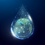 CLS’ Water Platform: Digitizing Water Resilience