← Back
How is satellite data helping the environment?

In a world where the changing environment and our impact is discussed, where forests and lands are burning, where global warming is raging, where pollution and the plundering of our natural resources happen every day, perhaps the innovations we need are those that serve the environment. CLS and its Earth data experts are unleashing the power of data and offering digital solutions to make our Planet sustainable.
Philippe Roques, Chief Technology Officer at CLS, spoke with us about these innovations that are at the service of the environment.
How is low-speed connectivity strategic for the Planet?
Before talking about technology, I would like to mention what drives us at CLS:
 Have you read Ian Urbina’s The Outlaw Ocean? It is an explosive investigation into the last wild frontier of the Planet: our oceans. He’s a journalist from the New York Times and found after 40 months of investigation, how our oceans are plundered daily and in an incredibly violent way, where illegality and crime are legion. This book is extraordinary both by its narrative and by the electroshock it provokes.
He finds that 20% of fish are caught illegally and that most of the world’s fish stocks are in crisis due to overfishing. He reminds us that by 2050, according to some studies, there will be less fish in the ocean than plastic, by weight. The seas are being plundered because governments do not have the means to protect them. In the latest report by the WWF (World Wildlife Fund), the world’s leading environmental protection organization, in 40 years, our planet will have lost 60% of its wild animals.
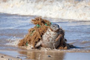
Faced with this mass extinction, we must act! The figures on pollution are just as alarming, not to mention the forests: in 2018 nearly 12 million hectares of tropical forests disappeared according to the World Resources Institute. This is the equivalent to the 86% of the French forest that disappears every year, and these figures were published before the fires that ravaged Brazil and Australia.
These examples are just a sample of the stresses weighing on our Planet. Every day, when we develop solutions for the environment at CLS, we have all these images and figures in our heads, and it’s a real driving force. The world’s population is growing, the world is changing, and digital innovations must above all be useful! Today, useful means managing emergency: the emergency to react, to study, understand, and prepare for the future. It also means adapting to address climate and environmental challenges, assessing the impact on our Planet of our economic activities and making the Planet sustainable.
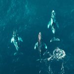
So, to answer your question, how is low-speed connectivity strategic for our planet? Well, first, it will enable us to track more animals. Today at CLS, we track more than 8,000 animals every month for the international scientific community. With new connectivity, we plan to track hundreds of thousands.
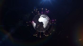
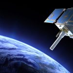
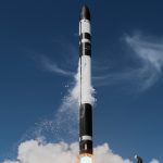
The connectivity I’m talking about is called Kinéis. This constellation of 25 nanosatellites to be launched in 2023 will carry the latest generation Argos payloads capable of locating any animal equipped with an Argos beacon. Giant jellyfish, lynx, cuckoo, golden eagle, reindeer, koala, kangaroo—any animal can be studied, thus understood and protected. This constellation, originally used for environmental applications, will then diversify its uses.
Scientists will have at their disposal a connectivity that is low speed, almost in real time, low power consumption, and smart (the system allows communication with the beacons). Above all, this Kinéis system and the Argos technology it carries onboard enables us to manufacture self-powered miniature transmitters (small battery or solar panels) – which is not possible with 5G. The smallest beacon weighs only 2g! Today, the system has 8 satellites in orbit, an array of more than 60 terrestrial antennas and a data processing center that works 24h/365 days a year. This low-speed Argos connectivity has already allowed us to rewrite the history of animal migrations, and with this “augmented version” by Kinéis, we can avoid the sixth extinction, which is why low-speed connectivity is strategic for the Planet.
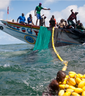
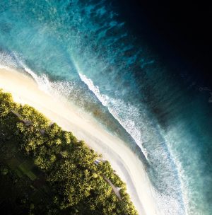
This connectivity will also be critical for the future of marine resources and local fisheries. Three years ago, we heard from Abdoulaye Seck, Coordinator of the Local Artisanal Fisheries Council of Dakar. He told us how global warming and overfishing were pushing fish further and further from the coast. Senegalese fishermen must brave danger daily to support their families. They travel more than 70Km from the shore in open wooden dugout canoes, equipped with only one small propeller motor. They can spend a week at sea harvesting the fruit of hard and dangerous work! Indeed, 70Km from the shore, there is no GSM coverage and satellite solutions for tracking and assistance requests are either too expensive or require power onboard, which small vessels don’t have. Low-speed connectivity will make it possible to equip these small-scale fishermen with affordable satellite coverage, as well as understand their impact on marine wildlife.
The possibilities for this connectivity are infinite: monitoring our water and its quality, sustainable agriculture, back up for in situ oceanography— so many pro-planet applications to be developed or improved!
To sum up, low-speed connectivity means hope for biodiversity, for sustainable agriculture, and for the future of local and traditional economies.
Today, data is everywhere. How can we make it meaningful and use it to help the environment?
You’re right, today, there is an enormous amount of data available. For example, the European Union’s Copernicus program, which is an ambitious Earth observation program, provides huge quantities of data: radar and optical imagery, altimetry data (ocean topography), and atmospheric data (air quality).
If we add the data from private imaging companies, you can quickly get drowned in the data or have various levels of precision in your data processing chains.
The challenge with data is therefore strategic and multiple. First, you must obtain “true data”, by which I mean data that is accurate, high quality, with integrity and intelligibility. Then you need to combine them with other data to get the answers you need; sometimes even discover things you didn’t expect.
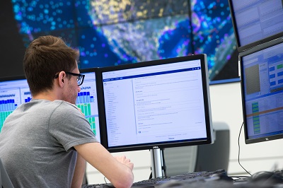
Let’s take an example: when protecting a country’s maritime domain, when you want to detect illegal fishing boats, you can use a radar image. That will show you all the large floating objects in a given area whether night, day or whether it is sunny or cloudy. Then, if you correlate this with the AIS (Automatic Identification System) positions of all kinds of vessels, you can identify the vessels in the image but only those who reveal their identity, because captains can turn off their AIS transmitter. Then you need to include VMS (Vessel Monitoring System) positions from compliant fishing vessels, since that system can’t be turned off. You can also add a layer of optical images, or video taken by drones, allowing you to detect or confirm other illegal activities (suspicious transshipments, illegal fish buoys, undeclared fish farms, etc.). Add a layer of Machine Learning and Deep Learning to automate detections and situations and you’ll have a formidable arsenal to fight environmental crime!
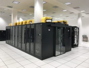
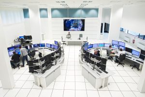
But to do this, you need to master Big Data technologies, set up the right infrastructure, and keep it up and running. At CLS, we have over 900 servers in our data center, which holds more than 3,000T Bytes of environmental data—a huge database on the state of the Earth’s environment.
We also of course develop solutions that are useful for our clients—an application to detect illegal activities at sea is different from one that detects crimes on land! The modus operandi of an illegal fisherman or a poacher of precious wood or endangered species are not the same, and these criminals do not operate in the same environments. All our applications are developed in close collaboration with our clients, and our analysts are all from the Navy or maritime or land law enforcement agencies.
Finally, the last strategic challenge to be met in working to save the environment: high-quality, reliable, augmented data AT THE RIGHT TIME. The best information arrives in time to be actionable! As they say, “There’s no point in arriving after the battle.”
For example, at CLS, we work for the European Maritime Safety Agency (EMSA), based in Lisbon, Portugal. After a satellite passes over an area of interest, we have only 20 minutes to deliver our pollution detection reports. This incredibly fast detection chain we’ve built has helped to cut in half the pollution in European waters in 10 years! To be efficient, at CLS, we maintain more than 100 treatment chains in operational conditions and our uptime rate is over 99.9%. We are very proud to maintain very high standards of performance and safety in order to serve the Earth!
So, in the end, CLS is a bit like Q for James Bond, providing all the latest tech, but for the environment?
(Laughs) Yes, a bit …
Our mission is to unleash the power of data. We’re an agent of change, and our goal is to help drive sustainability. This change is crucial for future generations and us as well, given the way things are going.
At CLS, we’re driven by new technologies. Today we work with Big Data, AI, DTL, and Blockchain; tomorrow, quantum computing! We combine different technologies for administrations and pro-planet actors all over the world. We offer smart, useful services to measure indicators, protect our planet, and sustainably manage our natural resources. And we’ve have been doing this for over 30 years.