Dec 9, 2015 | Environment and Climate
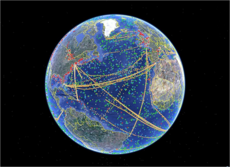
CLS processes, calibrates and distributes the data of more than 6000 oceanographic beacons to the international scientific community. The ocean can store 1000 times more heat than the atmosphere. The network of underwater ARGO floats measures the temperature...
Dec 8, 2015 | Environment and Climate
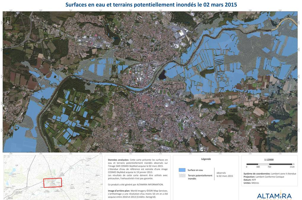
Since 2013, CLS and its subsidiary ALTAMIRA INFORMATION, have been mapping and delimiting flood zones of the Adour river in Dax, using their expertise in satellites and radar imaging. According to the IPCC report, “The proportion of the world population facing water...
Dec 8, 2015 | Environment and Climate, Land Management
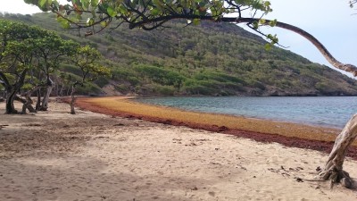
French West Indies beach invaded by Sargassum seaweed. CLS maps the seaweed ahead of time so it can be collected before reaching the shore. Since 2011, brown Sargassum seaweed has been amassing on the Caribbean and South American shoreline. As it decomposes, it emits...
Dec 7, 2015 | Environment and Climate
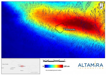
Often in the news, extreme climate situations are sadly becoming more frequent. How are we to deal with violent meteorological phenomena, cataclysmic earthquakes and migration of climate refugees? By using CLS’s world-wide operational satellite solutions for early...
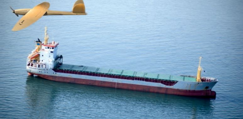
Dec 7, 2015 | Environment and Climate, Maritime Security
New technologies for environmental monitoring. UNDERWATER DRONES For years now, CLS has been using underwater drones known as gliders. They assess the quantity of CO2, plankton and hydrocarbons in seawater. We can also measure the effects of global warming, the...
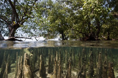
Dec 5, 2015 | Environment and Climate, Land Management
In 2015, the COP21, also known as the Paris Climate Change Conference, will attempt to obtain a universal, legally binding agreement on the climate, after more than 20 years of negotiations at the United Nations. Its goal is to keep global warming below...