← Back
When Water Rises Fast: Why Near Real-Time Flood Monitoring is Becoming Essential

Across many regions, hydrological systems are under increasing pressure. Changes in precipitation patterns, combined with evolving land use and urbanization, are influencing how water moves across territories and river basins.
As the climate warms, the atmosphere retains more moisture, leading to heavier precipitation and faster runoff. In many regions, the time between rainfall and rising water levels is shortening, making flood dynamics harder to anticipate using traditional approaches alone.
With decades of experience in Earth observation and environmental monitoring, CLS contributes to the understanding of water systems by transforming satellite data into actionable insights. This expertise is now applied to services such as FloodCare, designed to strengthen near real-time flood monitoring and situational awareness.
In this context, access to reliable, near real-time flood data is becoming essential to better understand evolving conditions and support timely decisions.
The Limits of Traditional Approaches
Flood risk management has long relied on historical data, hazard maps, modelling and statistical models. These tools remain key for planning, but they are based on past events and predefined scenarios.
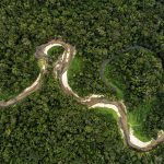
In fast-evolving situations, they may provide limited operational visibility. River systems can react quickly to intense rainfall, especially in urban areas, where water levels can rise within hours in certain places.
Monitoring networks based solely on in-situ sensors may also lack coverage at basin scale. As a result, there is a growing need for hydrological monitoring systems that integrate multiple data sources in near real time.
FloodCare: Turning Data into Operational Insight
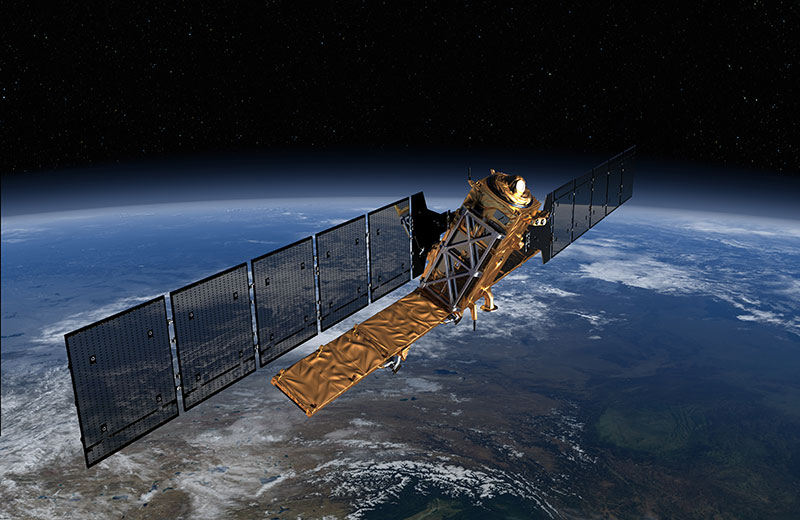
Advances in Earth observation and digital technologies have enabled new monitoring capabilities.
FloodCare, supported by the French Space Agency (CNES) as part of the France 2030 investment plan, aims to demonstrate round-the-clock operational services for flood surveillance and crisis management, in close alignment with the needs of public authorities such as the French Ministry of the Interior.
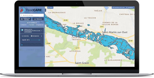
Developed by a consortium bringing together CS GROUP, SERTIT, CLS, VORTEX-IO, HYDROMATTERS and INRAE, the service integrates satellite data, in-situ measurements and hydrological modeling to deliver near real-time information on flood extent, water levels and impacted areas.
It enables:
- Rapid extraction of flooded area contours
- Detection of obstacles in flooded zones
- Continuous refinement of flood mapping
By combining multiple data sources and advanced processing methods, FloodCare supports authorities with actionable insights during flood events, helping improve coordination and response.
CLS Expertise in Operational Flood Monitoring
Within the FloodCare framework, CLS plays a key operational and technical role.
The teams are directly involved in 24/7 monitoring operations, ensuring continuity of service during critical periods. They also contribute to translating user needs into operational services, supporting training and facilitating the adoption of these tools by end users.
Recent activations illustrate this operational dimension. The service was first deployed to monitor flooding around Narbonne, followed by a second activation in Brittany. During these operations, satellite data from Sentinel-1 and very high-resolution commercial constellations were analysed to produce up-to-date flood assessments.
In February, during major flood events in western France, FloodCare was activated by the French Crisis Centre (COGIC). During one on-call period alone, dozens of satellite images were processed across multiple areas of interest, enabling continuous monitoring of evolving conditions.
These operations highlight how near real-time flood monitoring relies on both advanced technologies and dedicated expert teams, capable of delivering timely and reliable information under operational constraints.
Monitoring Water Systems in a Changing Climate
As climate variability increases, robust hydrological monitoring becomes more critical.
Flood events are becoming more intense and, in this context, resilience depends not only on infrastructure, but also on access to reliable and timely environmental information.
Solutions like FloodCare, combining flood monitoring, satellite observation and near real-time data, help strengthen situational awareness and support informed decision-making.

Looking Ahead
Managing flood risks in a changing climate requires approaches that combine scientific understanding with operational tools.
By integrating Earth observation and real-time hydrological monitoring, systems like FloodCare help bridge the gap between environmental data and decision-making.
Stay tuned for our next article, where we will meet our team behind the system and take a closer look at how their expertise supports near real-time flood monitoring and decision-making.