← Back
Unlocking Amazon’s Secrets: CLS at the Forefront of Discovery

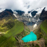
The Amazon is a gigantic river, the most powerful in the world. It’s responsible for 20% of the freshwater running into the ocean and is the largest contributor of fluvial sediments into the oceans.
The Amazon basin is known for its annual flooding, however, with the changing climate, the river’s floods and droughts are becoming more and more extreme and accentuating the problems of water resource management in terms of quantity and quality.
Jeremy Guilhen, born in Toulon, Studied Engineer in Agronomy at ENSAT (2014 – 2017). Began his thesis at CLS in 2020 and joined our ranks in 2023.
CLS researcher Jeremy Guilhen has just defended a thesis supervised by CLS experts in spatial hydrology and the Laboratoire Ecologie Fonctionnelle et Environnment (LEFE), experts in water quality modelling. After 3 years of research, he has demonstrated the impact of El Niño-Southern Oscillation (ENSO) on one of the world’s largest rivers in terms of flooding and sediment transportation.
It is also the first study that quantifies the water storage capacity of the floodplains of the Amazon basin as well as assessing how much fine sediment is transported into the ocean. We interviewed Jeremy, and he tells us all about it today.
Jeremy, why did you set up this research project?
I set up this research project because it is of significant importance. It fits in with the axes of understanding of processes in the Critical Zone and the Amazon basin, and sheds light on patterns that have been little known for decades. The study is based on an interdisciplinary approach, combining hydrodynamic and sedimentary modelling, satellite observations and in situ data.
This study was the first to determine the role of floodplains on a daily time step and at the scale of the entire Amazon watershed over the last 20 years and, it also provides a tool capable of providing a picture of the future risks associated with extreme climatic events in the Amazon hydrosystem.
How were you able to assess the amount of fine sediment?
When working at both such large scale and under gauged catchments it is paramount to design an integrated methodology based on modelling and remote sensing observations, especially for floodplains. So, I built more than 2,000 virtual stations in the floodplains to monitor them.
Why is understanding how much fine sediment is transported into the ocean important?
The changing climate and human activities are changing the amount of sediment transported by rivers and deteriorating water quality. Deforestation for example, increases soil erosion which means more soil and sediment in the water. Since water is becoming an increasingly precious commodity, understanding how much sediment is being transported is essential for effective water resource management.
Thank you Jeremy and well done for your thesis. After three years, you’ve officially joined our ranks, what made you choose to stay?
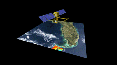
Being able to work on SWOT, which is a revolution in terms of hydrology is a great opportunity for me and something I find stimulating. Another deciding factor is being able to continue developing my skills and knowledge alongside experts here at CLS.
“I’m pleased to be able to say I work for a company whose values match my own. Understanding and protecting the planet is what motivates me and I’ve found my place at CLS.”
Preparing tomorrow’s experts today
With 30 years of experience developing innovative solutions, CLS understands that innovation is driven by expertise. This is why CLS continues to supervise theses in a variety of fields. With such a high demand, Franck Mercier Specialist Engineer and Jeremy’s thesis supervisor at CLS explains why Jeremy’s thesis was accepted.
“Supervising Jeremy’s thesis was important for us at CLS as it allowed us to re-enforce our partnership with the laboratory LEFE while enriching our experience in spatial hydrology.”
Did you know?
Since 2018 our experts at CLS have supervised 12 theses in the Environment & Climate field, including 5 in Hydrology.
CLS, a key player in space hydrology
Since 2015, CLS has applied its Altimetry expertise to water studies and management. We began monitoring 200 sites, in 2017 we added over 250 sites to this capacity, in 2018 a further 1,000 sites and today over 20,000 sites are being observed from space, by staff at CLS’ headquarters in Toulouse. For each observation, the height, and sometimes the volume and flow rate, are measured in near-real time.
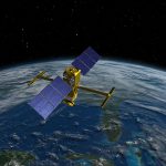
Now, our experts are at the heart of the validation of the first SWOT data since its launch. We are working with CNES on the qualification of water level products and the estimation of the performance of these observations for both instruments: KarIN, which provides high-resolution swaths, and the Nadir altimeter, which, thanks to its 21-day revisit, will be an essential link in the altimeter constellation that feeds the European water level services (Real Time and Climate) for which CLS is responsible on behalf of the European Commission.