← Back
Mangroves: natural barrier against rising waters

Today, the world is facing a growing freshwater crisis that is threatening people and the planet. Wetlands are the ecosystem that water and all life depend on the most and it is currently being destroyed.
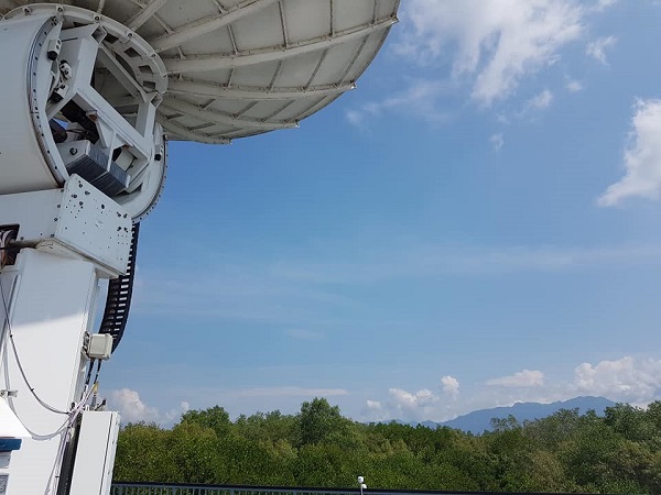
In honor of World Wetlands day, CLS takes a look back at the INDESO project. This project in Indonesia, with CLS as prime contractor, has proven that spatial solutions are key tools in integrated coastal zone management, particularly in monitoring the state of mangrove health.
Mangroves against rising waters
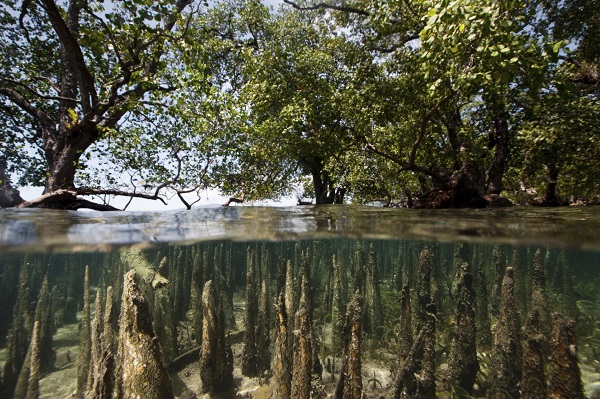
Mangroves at high tide
Bunaken Island, North Sulawesi, Indonesia
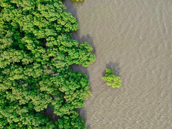
Mangroves are rare, spectacular and prolific ecosystems on the border between land and sea. These extraordinary ecosystems contribute to the well-being, food security and protection of coastal communities around the world. They support rich biodiversity and provide valuable nursery and rearing habitat for fish and shellfish. Mangroves also act as a natural form of coastal defence against storm surges, tsunamis, sea level rise and erosion. Their soils are very effective carbon sinks, sequestering large amounts of carbon.
An endangered ecosystem
Despite their value, mangroves are disappearing three to five times faster than global forest losses, with serious ecological and socio-economic impacts. Current estimates indicate that mangrove cover has halved over the past 40 years.
 The INDESO project: a tool for mapping mangroves
With the INDESO program, CLS has accompanied the Indonesian government in the study and protection of these habitats. How? By providing Indonesia with satellite observation tools and facilitating partnerships with French experts in the field of mangroves. Missions that have contributed to improving the integrated management of coastal areas, including mangrove monitoring.
The main challenge was then to monitor and protect Indonesian mangroves while accompanying the sustainable development of aquaculture and the coastline.
The research work carried out within the framework of the INDESO program enabled to draw conclusions and make recommendations to the stakeholders in the field.
 What are the results for the conservation of Indonesian mangroves?
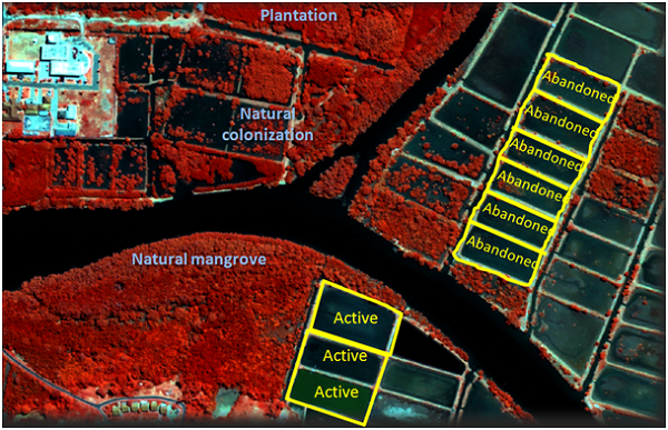
Scientists were able to observe that the walls and dykes of the ponds used for shrimp farming hampered the hydrological processes of tidal and freshwater flows, allowing the distribution of nutrients for the growth of mangrove seeds (propagules).
They also found that natural colonization in areas kept hydrologically open is more efficient than planting in closed ponds. In other words, mangrove replanting is not as effective as resting or preserving mangroves even after they have been uprooted.
Finally, scientists from IRD, a partner of the INDESO program, in partnership with Indonesian universities, have also detected that plantations of Rhizophora, a mangrove species, were not sustainable. A major risk of mass mortality in the years to come was then highlighted.
 The results of these observations led the research group to make recommendations to stakeholders:
- Define an annual acquisition plan for high-resolution optical imagery
- Establish a moratorium for the planting of Rhizophora monocultures.
- Test the opening of certain basins to analyze the natural recovery capacity.
- Set up a “mangrove spatial observatory” in each Indonesian area to evaluate :
- the risk of mass mortality in existing plantations
- the risk of soil erosion and degradation
the performance of ecosystem services provided by planted mangroves compared to natural mangroves. This observatory would combine basic field instruments, studies of mangrove characteristics and high spatial resolution images