← Back
ActInSpace 2018 : CLS’ challenges

ActInSpace is an innovation contest (Hackathon) initiated by the French Space Agency (CNES) uniting over 60 cities across 5 continents. This international event aims to bring together entrepreneurs, students, developers, creatives…
For 24 hours, teams will work on challenges proposed by various companies, with the support of business and technical experts, to imagine products and services, based on spatial technologies/data, that will be useful in everyone’s life.
The winning teams will be able to participate in the national and international finals and all promising projects can benefit from advice from the partner incubators and thus transform their project into a real company.
CLS is a partner of this event and propose three challenges to the candidates:
Wildlife under threat! How can we protect endangered species?
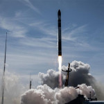
The Argos beacon is a unique satellite-based location and data collection system used for environmental protection. Thanks to this system, animals can be monitored (migrations, habitats, breeding grounds).
This challenge consists to imagine new ways to use Argos beacons to improve wildlife protection. You can use any type of data and environmental reports related to Argos data.
New Argos : new challenges!
Since thirty years, thanks to Argos beacons, we were able to locate and collect data for different applications: animal tracking, fishing, oceanography, transportation… Long before Internet of Things, Argos was the Internet of space! Argos’ operation is based on a satellite constellation which collect beacon’s signals and retransmits them to receiving stations with an average revisit time of approximately one hour.
The system is poised to become even more effective with the new Argos project: IoT platform, real time, more data, bidirectional link. This challenge consists to forecast the new potential uses of this tool: connected agriculture, connected transport, fight against environmental crime…
Reduce the environmental impact of maritime traffic using the AIS satellite!
As a specialist of maritime intelligence, CLS is renowned for the reliability of its data concerning maritime traffic. Using AIS (Automatic Identification System) technology, CLS provides a boat tracking system which constitutes a valuable ally as regards safety issues, economic intelligence and the fight against pollution.
Given that globalization has generated an increased trade, the need for maritime transport has also increased significantly, generating harmful impacts on the environment.
To tackle this challenge, you need to think of potential new applications that could use the data provided by a combination of “Open data & AIS”, i.e. data from AIS technology combined with other types of data of your own choice, to reduce the environmental impact of maritime traffic.