Our Coastal Resilience Services

Coastal Resilience: Strategic Data to Anticipate, Manage, and Adapt
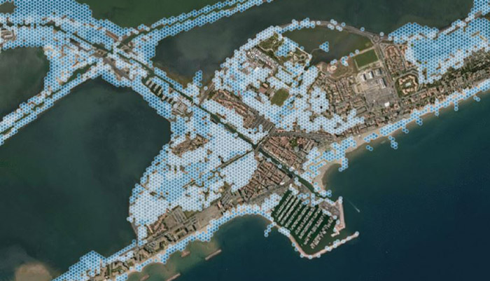
As climate change continues to impact coastal areas—rising sea levels, marine flooding, erosion, and human pressures—territories must equip themselves with tools that not only observe but also help understand and anticipate these challenges. CLS has developed a coastal flood risk estimation tool to meet this need.
Developed by CLS teams, this tool leverages over 30 years of Earth observation expertise. It goes beyond producing risk maps: it organizes information, reveals trends, and offers insights to support territories in their adaptation.
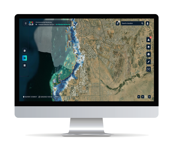
Conceived as a true digital command center, our platform centralizes information through an intuitive and scalable interface. Its ambition: to assist public decision-makers and planners in leading locally tailored resilience strategies built on knowledge and consensus.
A Platform Designed for Territorial Decision-Making
By combining advanced technologies, our platform delivers a dynamic view of coastal risks.
It integrates accurate data, proven algorithms, and interactive tools designed to support informed decision-making.
Identifying Flood-Prone Areas
Evaluating Vulnerabilities
Supporting Decision-Making and Stakeholder Engagement

Key Features
Map areas at risk of flooding

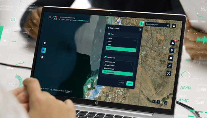
Project coastal changes across four timeframes: 2030, 2050, 2070, 2100
Estimate impacts based on three sea level rise scenarios

Optionally include decadal extreme events in simulations

Analyze socio-economic risks associated with coastal flooding
Adapt simulations to all low-lying coastal environments
Contact Us
Solutions that rise to your ambitions. Talk with our experts to discover how our innovative technologies can transform your operations.
Don’t wait — contact us today!