← Back
Innovating for the Planet: AI and Water Management with Jérémy Augot, Data Scientist at CLS
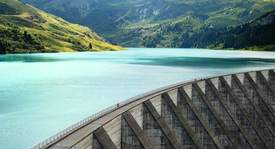
Climate change is intensifying global water stress, making the management of our water resources more critical than ever. At the forefront of this challenge, CLS and its experts in data science and satellite hydrology are developing innovative solutions to map water reservoirs with unprecedented precision.
Today, we spoke with Jérémy Augot, Data Scientist at the CLS Data Lab, to learn how artificial intelligence (AI) is revolutionizing bathymetric mapping (underwater topography), the estimation of reservoir volumes, and ultimately the improved management of our water resources.
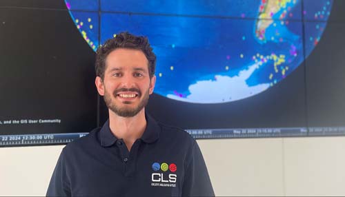
Jérémy Augot, Data scientist at CLS
Question: Jérémy, what is the main challenge water management experts face today in the context of climate change?Jérémy Augot: Climate change is increasing water stress, affecting the availability and management of water on a global scale. Optimized management of our water networks and reservoirs is therefore essential. To achieve this, we need precise knowledge of the volume of these reservoirs, which requires detailed information about their surface area and bathymetry (the topography of the lake or reservoir bed).
Q: Why is it easier to map the surface of reservoirs than their bathymetry?Jérémy Augot: The surface of reservoirs can be efficiently observed using satellite observation systems with optical or radar imagery, something our experts in satellite hydrology have been doing automatically for decades. However, bathymetry, which refers to the underwater topography of lakes and reservoirs, is more challenging because the necessary data is not always available.
 Q: How are AI and CLS’s data science experts contributing in this context?Jérémy Augot: This is where AI and our expertise in data science come into play. We’ve developed a method based on deep learning, training a neural network to generate reservoir bathymetry. Our strength lies in the combination of AI and satellite hydrology expertise. The in-depth knowledge of water-related data held by our experts allows us to train the neural network accurately, providing a reliable and realistic representation of the topography of the reservoirs studied.
Q: Can you explain how you are able to artificially and accurately reconstruct the bathymetry of reservoirs?Jérémy Augot: We reconstruct bathymetry by using the topographic context of the reservoir banks and surrounding areas, sometimes taking into account the terrain up to several kilometers away, depending on the size of the reservoir. By combining this contextual data with our deep learning model, we can accurately estimate the underwater topography of reservoirs, essentially the holy grail for calculating volume, which is a key piece of data for effective water resource management.
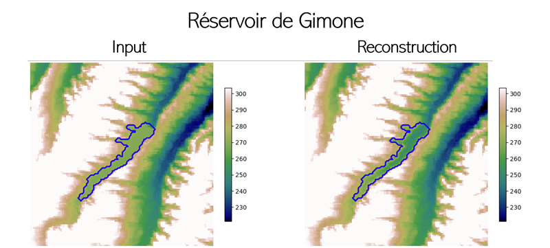
Bathymetric Reconstruction of the Gimone Reservoir, Southwest France – Direct Output from the CLS Algorithm. The reconstruction is based on the topographic context of the reservoir’s banks and surrounding areas. In the image on the left, we see the topography around Lake Gimone, with the studied lake surface outlined in blue. In the image on the right, we see the reconstructed bathymetry of the same lake as generated by the CLS model.
Q: How many reservoirs have you mapped so far?Jérémy Augot: So far, we’ve tested our approach on well-documented areas in France and Spain, covering 70 reservoirs. We calibrated our model using the known volumes of these reservoirs. Today, we are technically capable of generating bathymetry for any water surface in the world, as long as surrounding topographic data is available. Scaling this up globally requires a more extensive validation cycle, which is currently underway.

SWOT Satellite
Q: What personal impact has this project had on you?Jérémy Augot: Working on this project has been incredibly rewarding. I’ve had the opportunity to be involved in every stage, from the initial research to deploying the AI. Collaborating with CLS’s hydrology experts has been a privilege. Their deep knowledge of water data is crucial to the success of our AI, and it’s been both intellectually stimulating and a real pleasure to work with such highly skilled people.
Q: Can you tell us about your background?Jérémy Augot: I studied at CentraleSupélec and completed a double degree in Australia at the University of Queensland, where I specialized in AI and Deep Learning. I’ve been with CLS for over four years now, drawn by the opportunity to apply AI to environmental protection—and by the exceptional access to data and computing power the company offers.
Q: How does access to new technologies influence your work at CLS?Jérémy Augot: Access to cutting-edge technologies, especially cloud-based tools, enables us to develop essential data science capabilities. This is crucial for deploying real, user-friendly applications for our user communities. As part of CLS’s digital transformation, we’re helping deliver advanced data through platforms that are accessible to everyone, anywhere in the world.
Conclusion: Toward Optimized and Sustainable Water ManagementThanks to talents like Jérémy Augot, the expertise of CLS’s satellite hydrology specialists, and innovative technologies, CLS is leading the way in sustainable water resource management. By combining AI with hydrological expertise, we are advancing toward the essential understanding and protection of our water reservoirs, crucial for the future of our planet.
 The CLS DataLab
The CLS DataLab is an internal, cross-functional innovation unit within the CLS Group, made up of data scientists, developers, and Big Data engineers.
Its main goal is to develop large-scale data transformation software products and generate knowledge that adds value to raw data. These algorithmic transformations are based on Artificial Intelligence, particularly through machine learning (ML) and deep learning (DL) techniques. The Data Lab offers innovative solutions to solve complex problems and, in many cases, explores new approaches that push the boundaries of current technological capabilities.
Our DataLab brings together a diverse range of expertise within a single unit, all focused on data processing and machine learning: data visualization, supervised and unsupervised learning, deep learning, recurrent and feedforward models, and more.
The DataLab teams don’t just understand these technologies, they actively implement them to meet the business needs of the Group’s clients.
Régis Rauzy, Head of the CLS DataLab: “At CLS, we understand that technology is not an end in itself, but a means to achieve broader goals. Our teams are structured to bring AI, Machine Learning, and Deep Learning to experts across various fields,from environmental monitoring and sustainable fisheries management to maritime safety, energy, infrastructure, and mobility. We’ve embedded data scientists within our business units, working closely with clients and aligned with real-world needs. Together, we’re building bridges between big data and field specialists, enabling deeper, more informed insights into the activities we monitor.”