From Data to Strategic Operational Insights
Multi-source, Multi-criteria Data
CLS offers its clients, institutions, governments, scientific teams, and industrial stakeholders, innovative solutions based on satellite systems. The company delivers qualified, strategic, and multi-source information to support decision-making, integrating a wide variety of essential criteria.

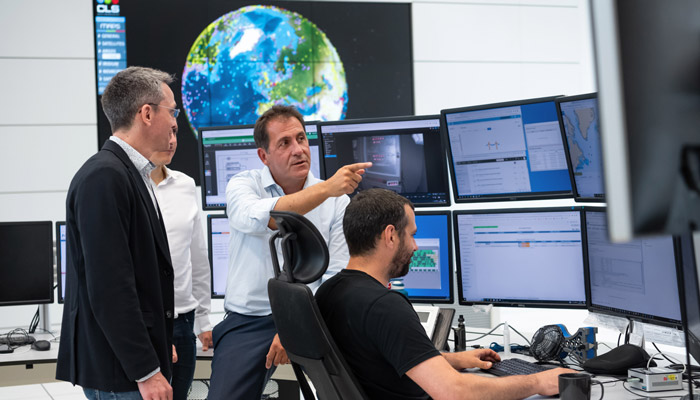
Unified, Streamlined, and Agile Operations
CLS has developed fast and seamless methods and processes thanks to an agile and scalable system. The company combines solid IT expertise with advanced technological proficiency.
Whether in the cloud or hosted in our data centers, data lies at the heart of our infrastructure—both internal and client-based. Our services run 24/7, 365 days a year.
We provide two types of operational support:
- IT support, focused on infrastructure, system administration, and database management
- Application support, focused on services related to application monitoring, product generation and archiving, and user-facing online services
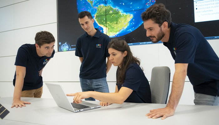
Business-Oriented Teams
With over 40 years of experience, CLS has built highly qualified technical teams with multidisciplinary skills.
Our specialists span a wide range of fields: signal processing, software development, imaging, data science engineering, machine learning, industrial mechanics, and domain expertise in oceanography, fisheries, acoustics, meteorology, urban planning, and geomatics.
Each solution is co-developed with our clients, leveraging the on-the-ground expertise of our teams, critical for addressing sector-specific needs.
High Value-Added Services
CLS specializes in data collection, including the design and industrial production of beacons, and provides consultancy on the development of satellite instruments for major national and European programs.
Our teams manage the full data lifecycle: acquisition (including operations and maintenance of ground antenna networks), processing, validation, modeling, and interpretation. We also conduct in-depth studies and analyses before disseminating the resulting information.
At CLS, we collect, merge, and enhance data to unlock its full potential.
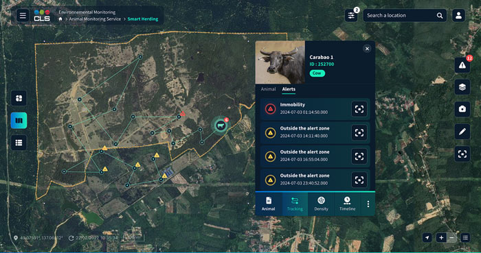
Digital Platforms for Decision-Making
CLS does not merely deliver data but provides tactical insights to decision-makers and planetary stewards. Through cloud-based information platforms powered by data science, CLS offers highly effective management tools for territories and operations.
Our solutions include qualified business data, precise indicators, auto-generated reports, as well as customizable analytics and alerts. Developed in SaaS mode by our experts in artificial intelligence and machine learning, these software tools open new perspectives for decision-makers and field actors committed to a sustainable planet, eco-conscious economy, and better quality of life.

Technology Serving Change
CLS positions itself as a driver of change, striving for a more sustainable planet through its mastery of cutting-edge technologies such as Big Data, AI, Machine Learning, and Deep Learning.
By combining these technologies, CLS delivers distinctive, intelligent, and relevant services tailored to qualified and customized uses.
With nearly 40 years of “Earth data” expertise, CLS leads the global market in services dedicated to planetary sustainability. Thanks to our technological expertise, we offer disruptive, innovative, and bespoke solutions.
We support change-makers, optimizers, and resilience builders by providing accurate, high-quality, real-time information to enable the best decision-making.
Key Figures
400 satellites deliver data to CLS annually
100 000 mobile assets are tracked daily from CLS headquarters in France (animals, fishing vessels, container ships, humanitarian trucks, ocean buoys, etc.)

+3.6 mm/an the rate of average sea level rise calculated by CLS, a global altimetry expert
+18 000 industrial fishing vessels and 6 000 artisanal or coastal fishing boats are tracked by CLS, which collects their positions and catch reports. These insights are shared with authorities through our beacons. CLS also monitors the entire global maritime traffic via SAT-AIS data—over 200 000 vessels
+60 000 terrestrial assets are tracked to optimize fleet management (for humanitarian efforts or waste collection)
+100 000 radar images processed by CLS’s Sentinel-1 Mission Performance Center