← Back
Unveiling the Urgent Reality of Polar Ice Sheets Melting – Insights from a Leading Ice Expert

Amid rising scientific concern over the world’s melting continental ice, the French president, Emmanuel Macron, has pledged €1bn to fund polar research between now and 2030.
Over the last 30 years, the planet’s frozen poles have lost 7,560 billion tons in mass with seven of the worst melting years occurring in the past decade. This dramatic loss already threatens millions and will soon threaten billions of the world’s inhabitants with multiple direct & indirect consequences.
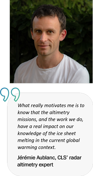
While these figures are a shocking revelation for some, it comes as no surprise to Jérémie Aublanc, CLS’ radar altimetry expert, who has been involved in R&D studies over land ice for 10 years now. The work Jérémie & his team do and the information they provide, to the IPCC and the scientific community, is crucial as it provides the world’s decision-makers with the information they need to change and implement new policies. We decided to find out more from Jérémie about where this information comes from.
Jérémie, what do you do at CLS?
Since I arrived in 2013, I have been working in the improvement of altimetry data processing, with a focus on the land ice thematic.
More specifically, I work in R&D studies with ESA and CNES to improve the quality of the topography estimations made with the radar signal over land ice. Thus, the objective for us is to estimate the ice surface elevation, and their variations over the time. With the last processing developed, this can be achieved at the centimeter level accuracy over Antarctica.
These data are used by the scientists working on climate change, to understand and quantify the impacts of global warming on the cryosphere.
Why is space altimetry important for climate observations?
Thanks to its global coverage and periodic revisit, satellite altimetry is a unique and powerful tool to monitor the surface topography of the polar ice sheets and ice caps.
We have radar altimeters observing continuously the cryosphere for 30 years now. This has substantially improved our knowledge of the ice sheet dynamics and their impacts. For example, through space altimetry we know that the melting of continental ice contributes to ~50% of the sea level rise.
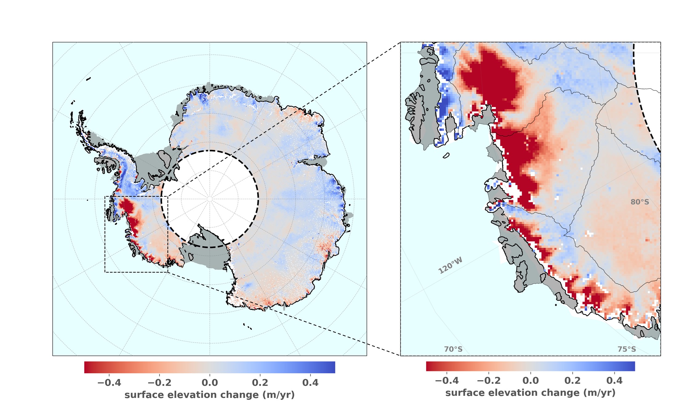
Surface elevation change over the Antarctic ice sheet during the 2019-2022 period, estimated with Sentinel-3 CLS AMPLI processing
What are the main outcomes from the recent studies?
I recently designed a new processing chain dedicated to the Copernicus Sentinel-3 mission measurements.
Thanks to the innovative algorithms developed, the mass balance trends derived from the Sentinel-3 Antarctica measurements are now in excellent agreement with the ICESat-2 reference mission. For instance, this confirms the dramatic ice losses occurring in West Antarctica. This is a major result for Sentinel-3, as the constellation will continue monitoring the ice sheets at least until 2035, and will be followed by Sentinel-3 Next Generation.
Thank you Jérémie for taking the time to talk with us.
CLS’ expertise in glaciology in high demand
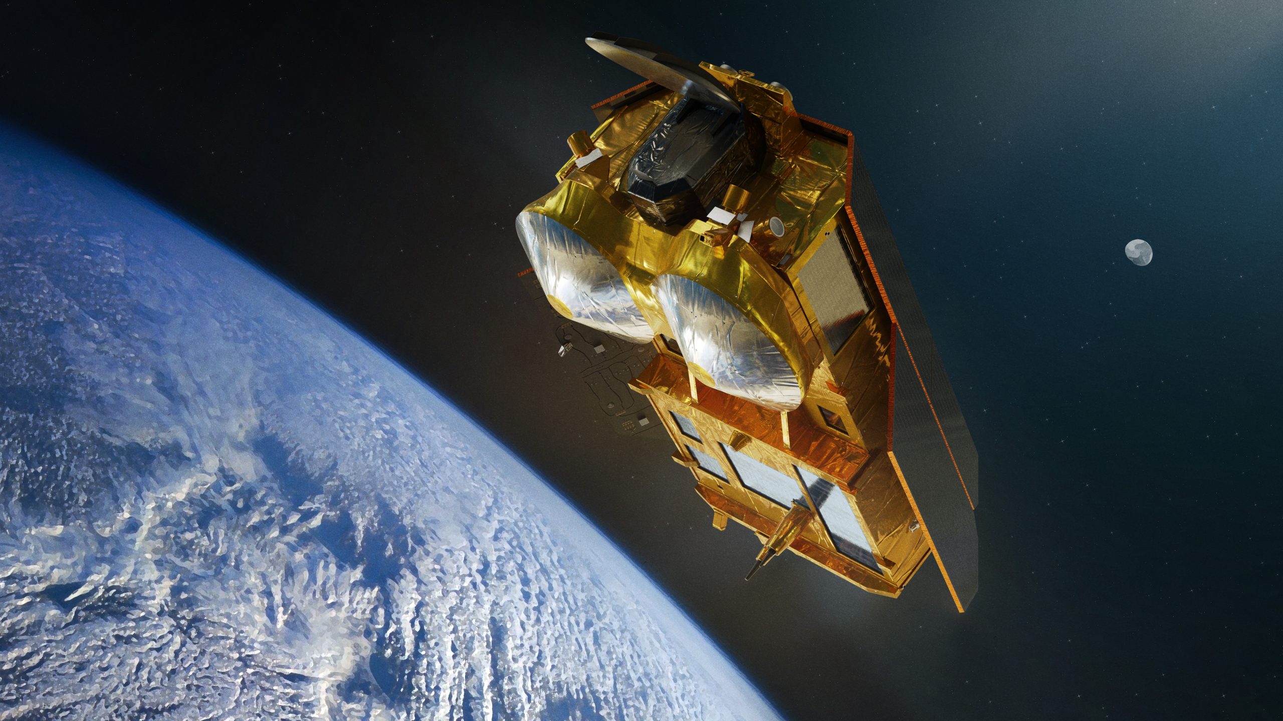
Future Copernicus Polar Ice and Snow Topography Altimeter, CRISTAL, mission
Thanks to Jérémie and his team’s work and expertise, CLS has been requested by the French Space Agency (CNES) and the European Space Agency (ESA) to generate Sentinel-3 Land Ice data for the users. In addition, CLS was solicited to help prepare the future Copernicus Polar Ice and Snow Topography Altimeter, CRISTAL, mission.
With a launch planned in 2027, the mission will carry, for the first time, a dual-frequency radar altimeter, and microwave radiometer, that will measure and monitor sea-ice thickness, overlying snow depth and ice-sheet elevations.
Related Posts:
 High Seas Treaty: UN Makes Historic Deal to Protect International Waters
 New step for the Indonesian Maritime Meteorological System (MMS1) delivered by CLS and its partners : High Performance Computing is now operational at BMKG HQ
 CLS’ Water Platform: Digitizing Water Resilience