← Back
European Commission Renews its Trust in CLS to Lead a Component of the Copernicus Global Land Service Until 2027

The European Copernicus program provides reliable and up-to date information on how our planet and its climate are changing which helps decision makers, businesses and citizens define environmental policies and take appropriate action.
 The Global Land Component of the Copernicus Land Service (CGLOPS) is part of the European flagship program on Earth Observation. Operational since 2013, the CGLOPS systematically produces a series of qualified bio-geophysical products on the status and evolution of the land surface.
These products are key information to monitor the land ecosystems at a global scale and at mid to low spatial resolution.
A contract has recently been signed with the Joint Research Center of the European Commission (JRC) enabling the consortium CGLOPS Lot-2 on the Hydrosphere and Cryosphere domain, led by CLS, to ensure the continuity of the CGLOPS service for another 4 years until 2027.
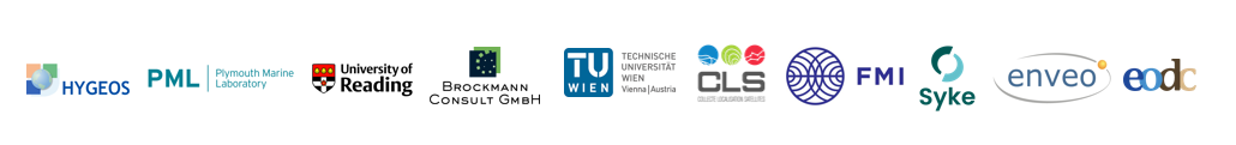
CLS, thanks to its vast expertise in Earth Observation, produces water level and water bodies extent and has been leading the hydrosphere and cryosphere components for more than 6 years along with its partners:
- CLS – water levels of lakes and rivers
- CLS, Technische Universitat Wien & EODC – water surface extent
- FMI, Skye and ENVEO – snow cover and ice extents and snow water equivalent
- Brockman Consult GMBH, Plymouth Marine Laboratory & Hygeos – water quality
- University of Reading – lakes water surface temperature
Every day the service collects around several thousand data and, since 2017, more than 2 million data has been collected globally. This data can be integrated into applications providing support in various domains such as water management, agriculture, nature conservation & restoration and mitigation/adaptation to climate change.
CLS, a key player in space hydrology

Since 2015, CLS has applied its Altimetry expertise to water studies and management.
We began monitoring 200 sites, in 2017 we added over 250 sites to this capacity, in 2018 a further 1,000 sites and today over 20,000 sites are being observed from space, by staff at CLS’ headquarters in Toulouse. For each observation, the height, and sometimes the volume and flow rate, are measured in near-real time.

Within the framework of the CGLOPS lot-2 on water and cryosphere project, CLS uses this experience to deliver water lever information on both rivers and lakes in a timely manner on more than 23,000 points of measurements and named virtual stations.
CLS also provides a monthly map of all water surfaces in the world and their seasonal dynamics at a resolution of 100m. For specific uses, maps at full-resolution, i.e. 20m, can also be provided on-demand and in the framework of hydrological services proposed by CLS.
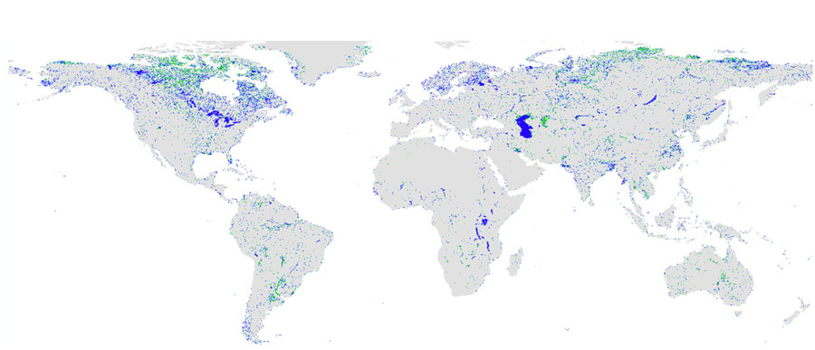
CLS Monthly Map of All Water Surfaces in the World and their Seasonal Dynamics
These products are vital for effective water resources management (hydrological modelling, continuous modelling of water surface quantity) and mitigation/adaptation to climate change (early warning systems).
Related Posts: