← Back
Desertification: the space, a tool to resilience

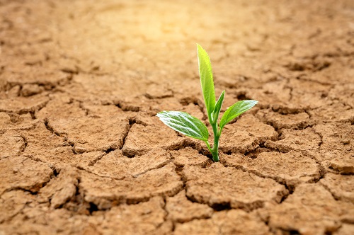
Desertification and land degradation are very serious challenges to humanity’s ability to survive in many areas of the world. They lead to hunger and poverty, unemployment, forced migration, and conflict, while increasing the risk of extreme weather events related to climate change.
According to The United Nations Convention to Combat Desertification (UNCCD) about 500 million people currently live within areas that have experienced desertification since the 1980’s. However, recent successes in restoration and sustainable land management show that these problems are not insurmountable. CLS works hand in hand with stakeholders to combat desertification from space.
 Combating desertification
The UNCCD states that to address desertification, we need to implement long-term integrated strategies that focus on:
- Improving already degraded land
- Ongoing rehabilitation and conservation
- Managing sustainable land and water resources.
Thanks to 30 years of experience, CLS experts have developed innovative solutions through various projects to help local and national authorities implement such strategies:
- Globland: mapping of hydrographic networks from space,
- Geoglam: development of a tool for rapid forecasting of agricultural production,
- Biocrust: capacity to characterize soil health and its potential/fragility,
- Sustainable Forest: global forest management system, accurate real-time monitoring of tree cover, automatic alert system for illegal deforestation,
- Eclat: ability to develop solutions based on Earth Observation (EO) and to estimate the effectiveness of projects funded by institutions.
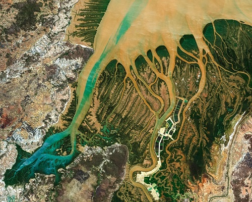
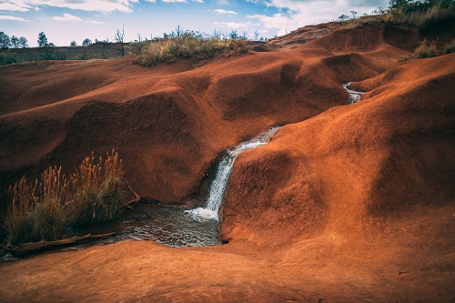 The Globland project: optimizing water resource management and land management
Today, spatial altimetry is an expected tool for the study and management of continental waters. Water heights, extent, flows are all data measured from space and integrated into the Copernicus Global Land Services platform. This platform provides access to hydrological data collected from space. CLS, along with CNES, LEGOS, CESBIO and other partners, is working to optimize the acquisition, processing, distribution and use of these hydrological data.
CLS is one of the world leaders in altimetry with more than 30 years of experience in the field.
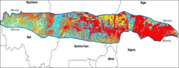
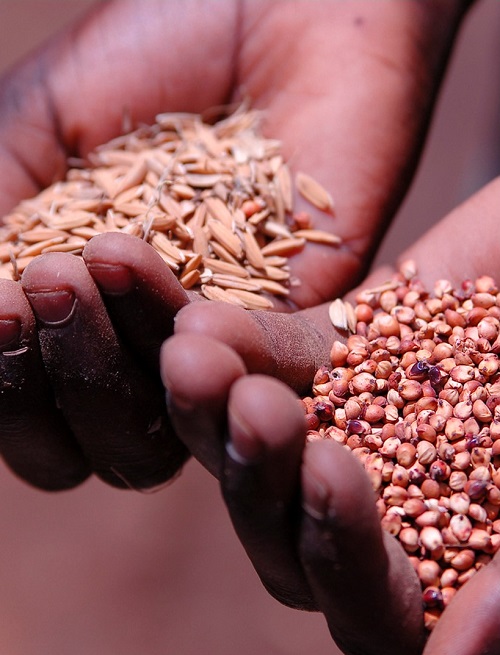 The Geoglam project: development of a rapid forecasting tool for agricultural production in Africa
The aim of this project is to support States in their national territorial policy decisions in terms of food security. How can we do this? By developing a tool based on optical imagery, field campaigns and a crop yield forecasting model.
Thanks to this model and to satellite and in situ data, CLS experts are able to predict the yield of plots. This gives the authorities the means to manage crops, adapt farming methods, anticipate shortages and buy grain for export at favorable prices if there is a shortage.
The areas currently concerned are: Kenya (75k km²), Tanzania (106k km²) and Uganda (86k km²).
 The Biocrust Project: capacity to characterize the health of soils, their potential and their fragility, development of a tool for territorial management
The objective of this project is to characterize the biological crusts of the Sahel from space. The biological ridges are analyzed, their health and potential analyzed.
This project, commissioned by the French National Research Agency (ANR), has enabled the development of a tool for prioritizing areas to be protected by identifying high-risk areas and high-potential areas.
 The Forest Service Project: a global forest management system, accurate real-time monitoring of tree cover, automatic alert system for illegal deforestation
Through dozens of sustainable forest management projects, CLS has developed solutions to:
- map tropical forest cover
- detect changes
- provide statistical indicators of forest cover evolution
- mapping activity data (IPCC nomenclature)
- strengthen the capacity of the territories
- contribute to the GFOI: contribution to the guide of methods and recommended practices.
The Eclat Project: developing solutions based on Earth Observation (EO)
The objective of the ECLAT project is to provide automated decision support tools based on satellite imagery to observe, assess, and predict the impacts of climate change, in a context of conflict, in the Lake Chad region.
Eclat attempts to understand the impact of investments in population stabilization on desertification (measuring the sustainability of vegetation resources or their fragility or even their endangerment due to the exploitation of displaced populations).
The project experts maximize the use of satellite data available in the framework of the SDGs and characterize the phenology of the vegetation. The results will be submitted at the end of the year to the African Union and the Lake Chad Commission.
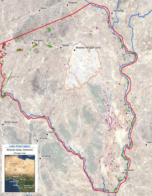
Map of the Lake Tchad region
On this figure we can see:
- in red the limits of the study;
- in blue the hydrographic networks;
- in orange, the boundary of the Minawao refugee camp that hosts victims of the Boko Haram movement. In 2017 it was estimated that nearly 65,000 people were placed in this center;
- in purple, red, green: the state of the forest cover in 2014, 2016 and 2019.
It should be noted that the presence of the camp in a region with weak natural resources has led to the extreme fragility of the forest cover and insecurity in the supply of firewood and cooking wood.
CLS has the capacity to process, analyze and model data from space observation to develop decision support tools, tools that can be used to implement effective national territorial policies to ensure food security and sustainable resource management.